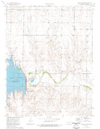
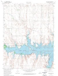
1974 Map of Cedar Bluff Dam
USGS Topo · Published 1976About this map
Cedar Bluff Dam and its expansive reservoir dominate this western Kansas landscape, where the Smoky Hill River was harnessed for irrigation and recreation. The map captures the infrastructure of the mid-1970s, including the Cedar Bluff National Fish Hatchery and several Historical Markers that nod to the region's pioneering past. Notably, the Overland Trail is traced across the terrain north of the river, marking the path of 19th-century westward migration.
Find a feature on this map
30 named features on this map. Tap any name to fly to it.
Don’t see what you’re looking for? This feature index may not catch every label — zoom into the map to look around manually.
Map Details
Editions of this 1974 Cedar Bluff Dam Map
This is the sole edition of this map. No revisions or reprints were ever made.
Other maps of this area

1893 · Ellis
USGS Topo · 1:125,000

1955 · Great Bend
USGS Topo · 1:250,000

1957 · Great Bend
USGS Topo · 1:250,000

1958 · Great Bend
USGS Topo · 1:250,000
1960 · Trego Center NE
USGS Topo · 1:24,000
1961 · Ogallah
USGS Topo · 1:24,000
1961 · Ellis
USGS Topo · 1:24,000
1974 · Cedar Bluff
USGS Topo · 1:24,000
1974 · Ellis SE
USGS Topo · 1:24,000
1980 · Mc Cracken NE
USGS Topo · 1:24,000