Old Maps of Trego County, Kansas
Explore 196 old maps of Trego County, spanning from 1893 to today. These high-resolution historic maps reveal how streets, neighborhoods, landmarks, and natural features evolved over time — perfect for genealogy, metal detecting, research, and local history exploration.
What you can do with these maps:
- See how Trego County changed over time: Compare historical maps to modern-day views to trace roads, homesites, rail lines & more.
- View detailed metadata: Each map includes creators, publishers, year, scale, and archive source.
- Overlay maps with satellite & LiDAR: Visualize the past alongside modern tools to explore terrain & human change.
- Trusted historical sources: Maps sourced from the USGS, Library of Congress, and other archives.
- Access maps your way: View online, download high-res files, or order prints for personal or research use.
Start exploring old maps of Trego County to uncover forgotten places, hidden landmarks, and the deep history beneath your feet.
Trego County, KS maps
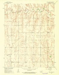
(196)- 1893 Map of Ellis
 1893 Ellis1893 Print · USGSRailroad expansion and high plains river topography define this corner of Western Kansas in the early 1890s. Researchers can trace the early townships and find specific landmarks like Round Mound, the town of Ellis, and the corridor of the Union Pacific Railroad.4 unique versions available
 - 1893 Map of Hill
 1893 Hill1893 Print · USGSNorthwestern Kansas in the early 1890s shows a landscape of developing prairie townships and the vital Union Pacific Railway corridor. Researchers can trace the early footprint of the historic colony at Nicodemus and find old stations like Millbrook and Paleo.4 unique versions available
 - 1954 Map of Goodland, 1976 Print
 1954 Goodland1976 Print · USGSNorthwest Kansas comes into focus during the mid-1950s, showing a landscape defined by its vital river forks and thriving rail towns. Researchers can trace the path of the Union Pacific through Colby or locate historic parks like Sheridan Co State Park.
 - 1955 Map of Great Bend, 1966 Print
 1955 Great Bend1966 Print · USGSCentral Kansas during the mid-sixties transition reveals a landscape defined by new reservoirs and enduring rail corridors. Researchers can trace the development of towns like Hays and Great Bend or locate natural landmarks such as Round Mound and the wetlands of the Quivira National Wildlife Refuge.3 unique versions available
 - 1955 Map of Scott City, 1969 Print
 1955 Scott City1969 Print · USGSWestern Kansas in the mid-fifties is captured here as a landscape of rural schoolhouses and significant rail corridors. Family historians can trace the locations of Skyline and Beaver Creek Schools or follow the Union Pacific line through Oakley and Sharon Springs.4 unique versions available
 - 1955 Map of Beloit, 1971 Print
 1955 Beloit1971 Print · USGSNorth Central Kansas in the mid-fifties shows a landscape of river-valley agriculture and expanding water infrastructure. Genealogists can trace the rail lines of the Union Pacific through towns like Nicodemus, Cawker City, and the State Sanatorium.3 unique versions available
 - 1956 Map of Goodland
 1956 Goodland1956 Print · USGSThe high plains of Northwest Kansas in the mid-fifties reveal a landscape of river-fed agriculture and expanding rail networks. Genealogists and historians can trace the development of county seats like Goodland and Atwood or locate landmarks such as the Arikaree Breaks.
 - 1957 Map of Goodland
 1957 Goodland1957 Print · USGSNorthwest Kansas in the mid-1950s shows a landscape of high plains agriculture and vital rail junctions. Researchers can trace the river-valley settlements from Goodland to Oberlin and follow the paths of the Union Pacific and Sappa Creek.2 unique versions available
 - 1957 Map of Great Bend
 1957 Great Bend1957 Print · USGSCentral Kansas at the peak of the postwar era shows a landscape of growing rail hubs and massive new water projects. Trace the routes of the Union Pacific through Hays or locate the newly formed shorelines of Cedar Bluff Reservoir and Kanopolis Reservoir.
 - 1958 Map of Great Bend
 1958 Great Bend1958 Print · USGSCentral Kansas in the late fifties reveals a landscape of high-plains agriculture and vital river crossings. Researchers can trace the development of regional hubs like Hays and Russell, or locate historic sites such as Fort Larned and the Cheyenne Bottoms wildlife area.2 unique versions available
 - 1958 Map of Scott City
 1958 Scott City1958 Print · USGSWestern Kansas at the peak of the post-war era reveals a landscape of high-plains agriculture and vital rail junctions. Genealogists and historians can trace old country school sites like Prairie Bell School, the landmark Chalk Pyramids, and small stops along the Union Pacific and Missouri Pacific.
 - 1959 Map of Beloit
 1959 Beloit1959 Print · USGSNorth Central Kansas at mid-century reveals a landscape shaped by river valleys and the expansion of massive water reservoirs. Genealogists and historians can trace the rail-town connections of Beloit and Norton or locate the site of the new Webster Dam.3 unique versions available
 - 1960 Map of Trego Center, 1962 Print
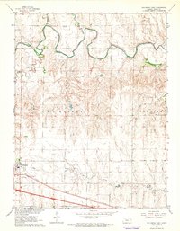
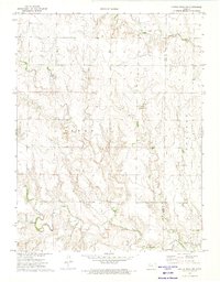
 1960 Trego Center1962 Print · USGSTrego County in the early sixties was a landscape of section-line roads and rural school districts centered around the small crossroads of Trego Center. Genealogists and local historians can locate early landmarks like Zion Cem and the Montrose Sch.
 - 1960 Map of Trego Center NE, 1962 Print
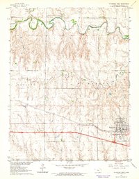
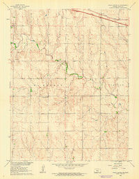 1960 Trego Center NE1962 Print · USGSTrego County was a land of prairie draws and emerging industry in the early sixties. Researchers can trace the rural school system at the Trego Center Sch or locate mid-century infrastructure like the Union Pacific and the Ogallah Field.
 - 1961 Map of Ogallah, 1962 Print
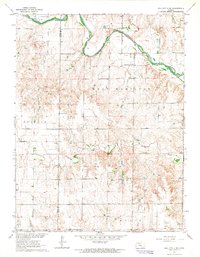
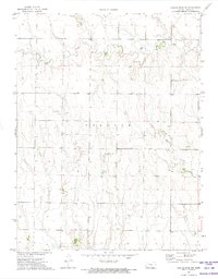
 1961 Ogallah1962 Print · USGSThe Trego County plains in the early sixties reveal a landscape shaped by the Union Pacific railroad and the Ogallah Oil Field. Genealogists and local historians can trace rural roots at the Ogallah Cem, Emanuel Ch, and Round Mound Sch.2 unique versions available
 - 1961 Map of Ellis, 1962 Print
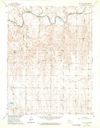
 1961 Ellis1962 Print · USGSThe town of Ellis sits at a vital rail and river junction in the early sixties, surrounded by the growing oil fields of Western Kansas. Genealogists and historians can locate St Marys Cem, trace the Union Pacific line, or find local landmarks like the Fairground.2 unique versions available
 - 1962 Map of Wa Keeney East, 1964 Print
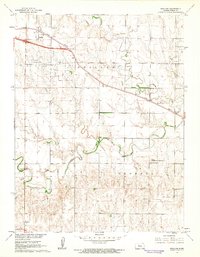
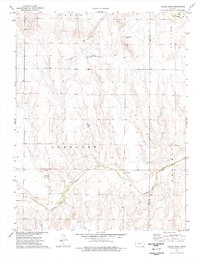
 1962 Wa Keeney East1964 Print · USGSThe High Plains of Trego County come into focus in the early sixties as the regional hub of Wakeeney expands along the Union Pacific line. Researchers can locate the WaKeeney Cem, trace the winding Saline River, and find mid-century landmarks like the Drive-in Theater.
 - 1963 Map of Wa Keeney West, 1964 Print
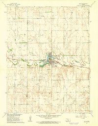
 1963 Wa Keeney West1964 Print · USGSWestern Kansas at the start of the sixties reveals a transition from river-bottom ranching to a rail-and-oil economy. Trace the route of the Union Pacific through WaKeeney or locate rural landmarks like the Saline Valley Cem and Pleasant Valley Community Hall.
 - 1963 Map of Hill City 4 SE, 1964 Print
 1963 Hill City 4 SE1964 Print · USGSWestern Kansas at the start of the sixties shows a landscape defined by prairie watercourses and a burgeoning petroleum industry. Genealogists and local historians can trace the rural community through St John Ch, Cottonwood Grove Sch, and the extensive Oil Field north of Spring Creek.2 unique versions available
 - 1963 Map of Hill City 4 SW, 1964 Print
 1963 Hill City 4 SW1964 Print · USGSKansas ranching and oil country come into focus in the early sixties as the Saline River meanders across the Trego County plains. Genealogists and researchers can trace the rural section lines to locate specific Oil Wells or explore the drainage of Spring Creek.2 unique versions available
 - 1972 Map of Castle Rock NW, 1974 Print
 1972 Castle Rock NW1974 Print · USGSThe Kansas high plains meet the historic westward route in the early seventies, spanning the border of Gove and Trego counties. Trace the Butterfield Overland Trail (Approx Location) past the Red Top Cem and local Well sites.
 - 1972 Map of Castle Rock NE, 1974 Print
 1972 Castle Rock NE1974 Print · USGSThe Trego County plains are captured here in the early 1970s, showcasing a landscape defined by deep creek drainages and rural life. Genealogists and historians can trace family-named landmarks like Banner Ch and the winding paths of Big Creek and Downer Creek.
 - 1974 Map of Castle Rock, 1976 Print
 1974 Castle Rock1976 Print · USGSWestern Kansas in the mid-seventies is documented here through its high plains terrain and historical transit corridors. Researchers can trace the path of the Butterfield Overland Trail and locate landmarks like the Castle Rock formations and the Smoky Hill River.
 - 1974 Map of Cedar Bluff Dam, 1976 Print
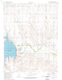 1974 Cedar Bluff Dam1976 Print · USGSThe Trego County plains are captured here in the mid-seventies, showing the impact of the Cedar Bluff Dam on the Smoky Hill River. Researchers can trace the Overland Trail or locate early energy sites like the Younger Oil Field.
 - 1974 Map of Gibson Creek, 1976 Print
 1974 Gibson Creek1976 Print · USGSWestern Kansas at the height of the 1970s reveals a landscape deeply connected to its pioneer past. You can trace the historic Butterfield (Approximate Overland Location) Trail and locate family-named landmarks like Gibson Creek and Hackberry Creek.
Showing maps 1-25 of 196
Top cities of Trego County
Frequently asked questions
- What are the different types of historical maps available for Trego County?
- What is the oldest map of Trego County?
- Where can I purchase historical maps of Trego County for my home or office?
- Where can I download high-res historical maps of Trego County?
- Are there historical topographic maps available for Trego County?
- Is there historical aerial imagery available for Trego County?
- Where are historical maps of Trego County sourced from?