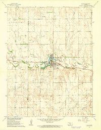
1961 Map of Ellis
USGS Topo · Published 1962About this map
Ellis serves as the central hub of this early 1960s landscape, positioned where the Union Pacific railroad tracks parallel the winding course of Big Creek. The town's layout is well-defined, showing local landmarks such as the Fairground, a local Park, and the Ellis Landing Field to the south. The surrounding terrain is heavily marked by the region's energy and resource economy, with numerous Oil Wells and an Oil Well scattered across the township lines. To the east, the elevation rises toward Pleasant Hill, while the western portion of the map is defined by the Trego and Ellis County boundary. Rural life is anchored by local sites like St Marys Cem and Mt Hope Cem, while the industrial footprint is noted through a Sewage Disposal plant and a Radio Tower that stands above the rolling plains.
Find a feature on this map
23 named features on this map. Tap any name to fly to it.
Don’t see what you’re looking for? This feature index may not catch every label — zoom into the map to look around manually.
Map Details
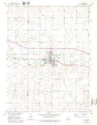
Editions of this 1961 Ellis Map
2 editions found
Other maps of this area

1893 · Ellis
USGS Topo · 1:125,000

1893 · Hill
USGS Topo · 1:125,000

1896 · Hays
USGS Topo · 1:125,000

1896 · Plainville
USGS Topo · 1:125,000

1955 · Great Bend
USGS Topo · 1:250,000

1955 · Beloit
USGS Topo · 1:250,000

1957 · Great Bend
USGS Topo · 1:250,000

1958 · Great Bend
USGS Topo · 1:250,000

1959 · Beloit
USGS Topo · 1:250,000

1961 · Yocemento
USGS Topo · 1:24,000