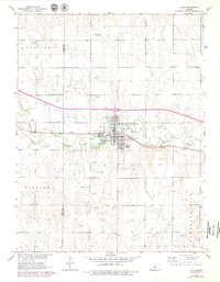
1961 Map of Ellis
USGS Topo · Published 1979About this map
Big Creek meanders through the heart of Ellis, Kansas, providing a natural focal point for this Great Plains community. The 1961 data, updated with 1978 aerial revisions, shows a landscape defined by the intersection of traditional infrastructure and modern energy extraction. The Union Pacific railroad corridor anchors the town center, while the surrounding prairie is dotted with a high density of oil wells, particularly within the Pleasant Hill Oil Field. Local civic life is reflected in the fairground, Golf Course, and Swimming Pool concentrated near the water. For genealogists, the map identifies both Mt Hope Cem and St Marys Cem on the town's periphery. The transition from agricultural township layouts to industrial use is evident in the numerous drill holes and gravel pits scattered across the Trego and Ellis county line.
Find a feature on this map
26 named features on this map. Tap any name to fly to it.
Don’t see what you’re looking for? This feature index may not catch every label — zoom into the map to look around manually.
Map Details
Editions of this 1961 Ellis Map
2 editions found
Other maps of this area

1893 · Ellis
USGS Topo · 1:125,000

1893 · Hill
USGS Topo · 1:125,000

1896 · Hays
USGS Topo · 1:125,000

1896 · Plainville
USGS Topo · 1:125,000

1955 · Great Bend
USGS Topo · 1:250,000

1955 · Beloit
USGS Topo · 1:250,000

1957 · Great Bend
USGS Topo · 1:250,000

1958 · Great Bend
USGS Topo · 1:250,000

1959 · Beloit
USGS Topo · 1:250,000

1961 · Yocemento
USGS Topo · 1:24,000