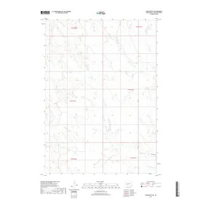
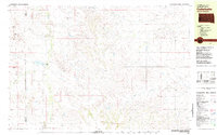
2017 Map of Cedar Butte NE
USGS Topo · Published 2017About this map
Cottonwood Cr and Larvie Cr define the drainage patterns of this Mellette County landscape within the Swift Bear Segment. The terrain is characterized by a complex network of intermittent stream beds, including Runs Close Cr and Yukni Cr, which cut through the high plains topography. Human activity in this rural South Dakota corridor is marked by a sparse but essential grid of local routes like 255th Ave and Running Bird Rd. The map provides a detailed view of the Public Land Survey System (PLSS) divisions, such as t43n r32w and t44n r31w, which historically governed land claims and agricultural allotments in this region. This survey serves as a modern record of a landscape where the natural hydrology of Porcupine Cr remains a more dominant feature than the built environment.
Find a feature on this map
13 named features on this map. Tap any name to fly to it.
Don’t see what you’re looking for? This feature index may not catch every label — zoom into the map to look around manually.
Map Details
Editions of this 2017 Cedar Butte NE Map
This is the sole edition of this map. No revisions or reprints were ever made.
Other maps of this area
1951 · Stamford SW
USGS Topo · 1:24,000
1951 · Stamford SE
USGS Topo · 1:24,000
1951 · Cedar Butte NW
USGS Topo · 1:24,000
1951 · Cedar Butte NE
USGS Topo · 1:24,000
1951 · Okaton SW
USGS Topo · 1:24,000
1951 · Murdo 3 NW
USGS Topo · 1:24,000

1955 · Martin
USGS Topo · 1:250,000

1958 · Martin
USGS Topo · 1:250,000
1980 · Kadoka
USGS Topo · 1:100,000
1981 · Cedar Butte
USGS Topo · 1:25,000