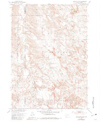
1951 Map of Cedar Butte NW
USGS Topo · Published 1981About this map
Pine Ridge Indian Reservation lands dominate this western South Dakota landscape, where the Reservation Boundary follows the divide between Washabaugh Co and Mellette Co. The terrain is defined by a dense network of drainages including Black Pipe Creek, Cottonwood Creek, and Porcupine Creek, which cut through the open country of Prospect and Cedar Butte. Human settlement is sparse and tied to the water and grazing potential of the plains, most notably at the Walker Ranch in the north.
Find a feature on this map
17 named features on this map. Tap any name to fly to it.
Don’t see what you’re looking for? This feature index may not catch every label — zoom into the map to look around manually.
Map Details
Editions of this 1951 Cedar Butte NW Map
2 editions found
Other maps of this area

1951 · Stamford SW
USGS Topo · 1:24,000

1951 · Belvidere
USGS Topo · 1:24,000

1951 · Stamford SE
USGS Topo · 1:24,000

1951 · Cedar Butte NW
USGS Topo · 1:24,000

1951 · Cedar Butte NE
USGS Topo · 1:24,000

1951 · Pass Creek NE
USGS Topo · 1:24,000

1955 · Martin
USGS Topo · 1:250,000

1958 · Martin
USGS Topo · 1:250,000

1980 · Kadoka
USGS Topo · 1:100,000

1981 · Cedar Butte
USGS Topo · 1:25,000