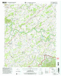
2003 Map of Cedar Creek
USGS Topo · Published 2004About this map
The Nolichucky River winds through the heart of this landscape, its path defined by numerous named islands including Susong Island and Jones Island, as well as the significant Walker Ford. This 2003 revision reflects a deeply established rural community characterized by parallel valleys like Evans Valley and Seven Springs Valley. The intersection of river and road is anchored by the historic Meadow Creek Mill and a series of rural crossroads such as Walter Crossroad and Russell Crossroad.
Find a feature on this map
52 named features on this map. Tap any name to fly to it.
Don’t see what you’re looking for? This feature index may not catch every label — zoom into the map to look around manually.
Map Details
Editions of this 2003 Cedar Creek Map
This is the sole edition of this map. No revisions or reprints were ever made.
Other maps of this area

1883 · Morristown
USGS Topo · 1:125,000

1892 · Greeneville
USGS Topo · 1:125,000

1893 · Mt Guyot
USGS Topo · 1:125,000

1893 · Morristown
USGS Topo · 1:125,000

1894 · Asheville
USGS Topo · 1:125,000

1895 · Morristown
USGS Topo · 1:125,000

1896 · Greeneville
USGS Topo · 1:125,000

1901 · Asheville
USGS Topo · 1:125,000

1904 · Greeneville
USGS Topo · 1:125,000

1912 · Mt Guyot
USGS Topo · 1:125,000