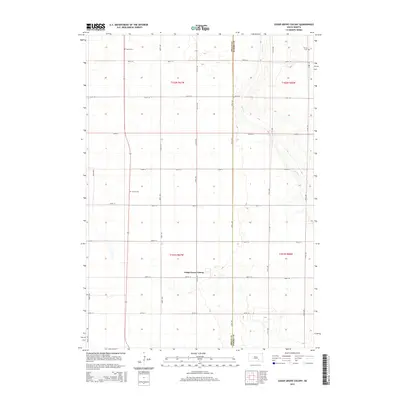
2015 Map of Cedar Grove Colony
USGS Topo · Published 2015About this map
Cedar Grove Colony stands as a focal point in this portion of the South Dakota prairie, situated at the intersection of 369th Ave and 266th St. This area of Brule County and Aurora County is defined by a strictly rectilinear grid of section roads, including 260th St through 267th St, which partition the landscape for agricultural use. The terrain is marked by the winding course of Platte Cr, which provides the primary drainage through the eastern sections of the quadrangle.
Find a feature on this map
24 named features on this map. Tap any name to fly to it.
Don’t see what you’re looking for? This feature index may not catch every label — zoom into the map to look around manually.
Map Details
Editions of this 2015 Cedar Grove Colony Map
This is the sole edition of this map. No revisions or reprints were ever made.
Other maps of this area

1955 · Mitchell
USGS Topo · 1:250,000

1959 · Mitchell
USGS Topo · 1:250,000

1979 · Cedar Grove Colony
USGS Topo · 1:24,000

1979 · Laffey Lake
USGS Topo · 1:24,000

1979 · White Lake
USGS Topo · 1:24,000

1979 · Platte Lake
USGS Topo · 1:24,000

1979 · Joubert
USGS Topo · 1:24,000

1979 · Lake George
USGS Topo · 1:24,000
1979 · Platte
USGS Topo · 1:24,000

1979 · Kimball South
USGS Topo · 1:24,000
Featured Places
- Torrey Lake Township, SD
- Cedar Grove Hutterite Colony, SD
- Wilbur Township, SD
- Gales Township, SD
- Washington Township, SD