
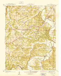
1938 Map of Cedar Hill
USGS Topo · Published 1938About this map
The Big River carves a winding path through Jefferson County, anchoring a rural landscape defined by narrow valley settlements and upland ridges in the late 1930s. This survey, topographic work by W. B. Brewer, illustrates a traditional river-based economy where crossings like Mcculloch Ford and centers such as Morse Mill served as local hubs. The area is dotted with small, one-room schoolhouses that once anchored these communities, including Mayfield Sch, Calvey Sch, and Maple Grove Sch, many of which were the social hearts of places like Dittmer and Oermann. The drainage pattern is exceptionally detailed, showing the convergence of Wine Creek, Dry Creek, and Jones Creek into the main river channel. Local religious life is centered at St Martins church, while the presence of Flatrock Camp suggests the early recreational use of the river's edge. The boundary between Franklin Co and Jefferson Co runs along the western edge, cutting through the high ground above Calvey Creek.
Find a feature on this map
29 named features on this map. Tap any name to fly to it.
Don’t see what you’re looking for? This feature index may not catch every label — zoom into the map to look around manually.
Map Details
Editions of this 1938 Cedar Hill Map
2 editions found
Other maps of this area

1901 · De Soto
USGS Topo · 1:125,000

1930 · De Soto NE
USGS Topo · 1:24,000

1930 · Pacific SE
USGS Topo · 1:24,000

1931 · Pacific NE
USGS Topo · 1:24,000

1937 · Pacific
USGS Topo · 1:24,000

1937 · Fletcher
USGS Topo · 1:24,000

1938 · Fletcher
USGS Topo · 1:24,000

1940 · Cedar Hill
USGS Topo · 1:24,000

1946 · Richwoods
USGS Topo · 1:62,500

1947 · St. Clair
USGS Topo · 1:62,500