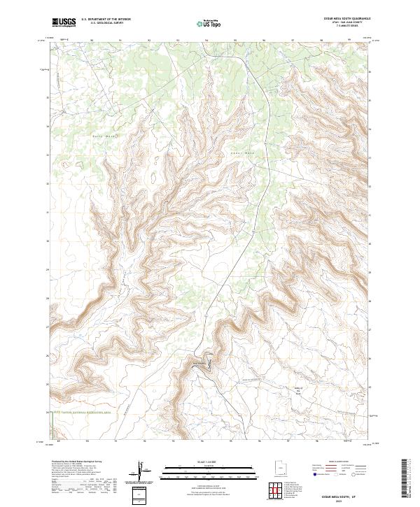
2023 Map of Cedar Mesa South
USGS Topo · Published 2023About this map
The dramatic switchbacks of the Moki Dugway descend through the steep terrain of southeastern Utah, connecting the high plateau of Cedar Mesa to the lower desert floor. This 2023 survey details a landscape defined by deep erosional features like Johns Canyon and the elevated expanse of Polly Mesa. The southern portion of the map transitions into the Glen Canyon National Recreation Area, where the drainage of West Fork Lime Creek carves through the sandstone. The layout of Valley Of The Gods Rd and Mule Point Rd reflects the era's focus on maintaining access to these remote geological landmarks while preserving the wilderness character of the Four Corners region.
Find a feature on this map
9 named features on this map. Tap any name to fly to it.
Don’t see what you’re looking for? This feature index may not catch every label — zoom into the map to look around manually.
Map Details
Editions of this 2023 Cedar Mesa South Map
This is the sole edition of this map. No revisions or reprints were ever made.
Other maps of this area

1886 · Henry Mountains
USGS Topo · 1:250,000

1886 · Abajo
USGS Topo · 1:250,000

1892 · Abajo
USGS Topo · 1:250,000

1892 · Henry Mountains
USGS Topo · 1:250,000

1893 · Abajo
USGS Topo · 1:250,000

1956 · Escalante
USGS Topo · 1:250,000

1956 · Cortez
USGS Topo · 1:250,000

1958 · Cortez
USGS Topo · 1:250,000

1959 · Cortez
USGS Topo · 1:250,000

1960 · Escalante
USGS Topo · 1:250,000