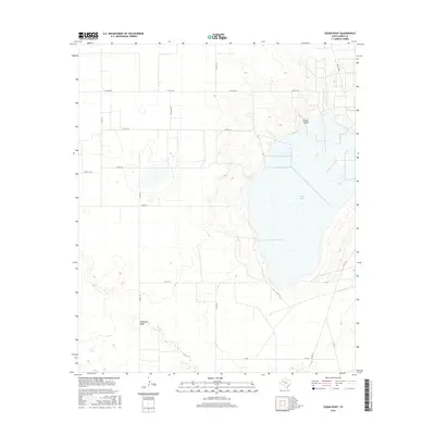
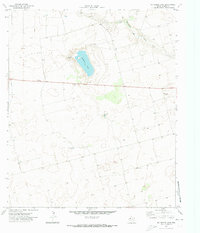
2016 Map of Cedar Point
USGS Topo · Published 2016About this map
Cedar Lake dominates the central and eastern portion of this West Texas landscape, providing a significant hydrological landmark in an otherwise arid expanse of Gaines County. The shoreline is defined by the prominent Cedar Point landform, which overlooks the salt lake and its surrounding drainage systems. To the south, the ephemeral waterway of McKenzie Draw cuts through the terrain, illustrating the natural drainage patterns that have historically shaped land use in this part of the Llano Estacado. The map reveals a highly structured grid of rural infrastructure, where farm-to-market roads like FM RD 1066 and a network of county roads, including Co RD 139 and Co RD 114, facilitate access to the surrounding agricultural and ranching parcels. This network highlights the transition from natural topographical features to a systematically organized human landscape.
Find a feature on this map
17 named features on this map. Tap any name to fly to it.
Don’t see what you’re looking for? This feature index may not catch every label — zoom into the map to look around manually.
Map Details
Editions of this 2016 Cedar Point Map
This is the sole edition of this map. No revisions or reprints were ever made.
Other maps of this area

1954 · Hobbs
USGS Topo · 1:250,000

1958 · Hobbs
USGS Topo · 1:250,000
1969 · Loop
USGS Topo · 1:24,000
1969 · Ashmore
USGS Topo · 1:24,000
1969 · Welch SW
USGS Topo · 1:24,000
1969 · Welch West
USGS Topo · 1:24,000
1970 · McKenzie Lake NW
USGS Topo · 1:24,000
1970 · Loop SW
USGS Topo · 1:24,000
1970 · Sand
USGS Topo · 1:24,000
1970 · McKenzie Lake
USGS Topo · 1:24,000