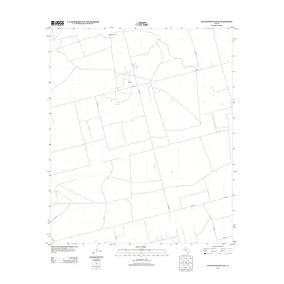
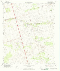
2012 Map of Cedar Point Ranch
USGS Topo · Published 2012About this map
Cedar Point Ranch serves as a primary geographic anchor in this section of the Texas Panhandle, where the landscape is defined by the geometric precision of the High Plains road grid and petroleum extraction. The presence of the Amrow Oil Field near the center of the sheet highlights the industrial character of the region during the early twenty-first century. A complex network of local routes, including Radar Rd, Plant Rd, and Molley Ln, facilitates movement between ranching outposts and oil production sites. While the terrain appears largely open, the detailed mapping of county roads like Co Rd 422 and state-maintained routes such as FM 1788 provides a clear view of the infrastructure supporting this rural economy. This 2012 survey illustrates how modern energy development and traditional ranching coexist across the Gaines County landscape.
Find a feature on this map
15 named features on this map. Tap any name to fly to it.
Don’t see what you’re looking for? This feature index may not catch every label — zoom into the map to look around manually.
Map Details
Editions of this 2012 Cedar Point Ranch Map
This is the sole edition of this map. No revisions or reprints were ever made.
Other maps of this area

1954 · Hobbs
USGS Topo · 1:250,000

1958 · Hobbs
USGS Topo · 1:250,000
1970 · Seminole NE
USGS Topo · 1:24,000
1970 · Cedar Point Ranch
USGS Topo · 1:24,000
1970 · McKenzie Lake NW
USGS Topo · 1:24,000
1970 · Seminole SE
USGS Topo · 1:24,000
1970 · McKenzie Lake SE
USGS Topo · 1:24,000
1970 · McKenzie Lake
USGS Topo · 1:24,000
1971 · Five Wells Ranch NW
USGS Topo · 1:24,000
1971 · Florey
USGS Topo · 1:24,000