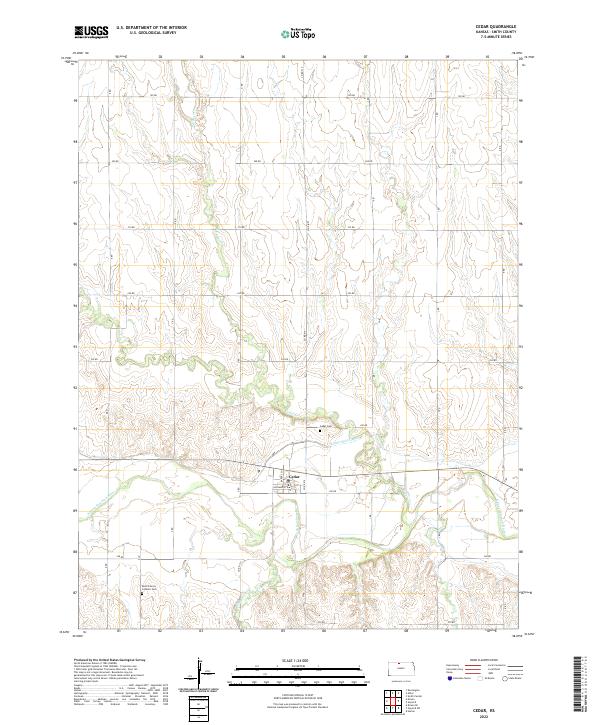
2022 Map of Cedar
USGS Topo · Published 2022About this map
The N Fork Solomon River valley defines the landscape in this portion of Smith County, where the small settlement of Cedar serves as a local focal point near the river's edge. The town's grid is centered on Kansas St and Solomon St, situated just north of the winding river course. This 2022 survey illustrates the modern agricultural footprint of the region, characterized by a regular network of rural routes like Co Rd 515 and 240 Rd that partition the rolling plains. Water management is a visible priority for the local farming economy, evidenced by the Kirwin Main Canal which cuts across the terrain south of Cedar Cr. For those researching local history or genealogy, the map identifies two significant burial grounds: Cedar Cem near the town site and the Saint Francis Catholic Cem located further south along Glen Rock Cr.
Find a feature on this map
35 named features on this map. Tap any name to fly to it.
Don’t see what you’re looking for? This feature index may not catch every label — zoom into the map to look around manually.
Map Details
Editions of this 2022 Cedar Map
This is the sole edition of this map. No revisions or reprints were ever made.
Other maps of this area

1893 · Smith Center
USGS Topo · 1:125,000

1893 · Phillipsburg
USGS Topo · 1:125,000

1955 · Beloit
USGS Topo · 1:250,000

1959 · Beloit
USGS Topo · 1:250,000

1961 · Kirwin SE
USGS Topo · 1:24,000

1961 · Harlan
USGS Topo · 1:24,000

1961 · Gaylord SW
USGS Topo · 1:24,000

1972 · Kirwin
USGS Topo · 1:24,000

1973 · Kensington
USGS Topo · 1:24,000

1973 · Athol
USGS Topo · 1:24,000