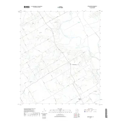
2019 Map of Cedar Springs
USGS Topo · Published 2019About this map
The Brazos River meanders across this Falls County landscape, defining the local geography with its wide curves and distinct features like The Falls and Wild Horse Slough. The rural settlement of Cedar Springs serves as a central point, surrounded by a network of farm-to-market roads and county routes that trace the area's agricultural heritage. Numerous family and community burial grounds, including Gravel Hill Cem, Bull Hill Cem, and Jerusalem Cem, are scattered throughout the quadrangle, offering significant points of interest for genealogists tracing early residents. The terrain is marked by seasonal drainages such as Poole Cr and Hog Cr, while Lake Winiwaca provides a localized water body near the confluence of Cottonwood Br. The layout of the roads and the placement of the various cemeteries relative to Pleasant Grove reflect a long-established pattern of rural Texas habitation.
Find a feature on this map
64 named features on this map. Tap any name to fly to it.
Don’t see what you’re looking for? This feature index may not catch every label — zoom into the map to look around manually.
Map Details
Editions of this 2019 Cedar Springs Map
This is the sole edition of this map. No revisions or reprints were ever made.
Other maps of this area
1892 · Temple
USGS Topo · 1:125,000
1954 · Waco
USGS Topo · 1:250,000
1955 · Waco
USGS Topo · 1:250,000
1957 · McClanahan
USGS Topo · 1:24,000
1957 · Chilton
USGS Topo · 1:24,000
1957 · Marlin
USGS Topo · 1:24,000
1961 · Baileyville
USGS Topo · 1:24,000
1962 · Rosebud
USGS Topo · 1:24,000
1962 · Reagan
USGS Topo · 1:24,000
1962 · Cedar Springs
USGS Topo · 1:24,000