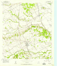
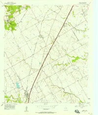
1957 Map of Chilton
USGS Topo · Published 1958About this map
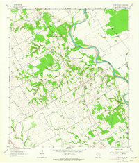
Chilton serves as the central hub for this mid-century portrait of southern Falls County, where the Texas and New Orleans (Southern Pacific) railroad tracks cut a diagonal path through the landscape. This corridor connects small trackside communities like Satin and Guda to the larger rail network. The terrain is defined by a dense network of waterways, including Cow Bayou and Deer Creek, which drain toward the prominent Brazos River at the eastern edge of the quadrangle. Beyond the rail lines, the map documents a rural landscape punctuated by local landmarks like Little Deer Creek Ch and the dispersed settlements of North Prairie and Cedar Valley. Extensive levee systems along the bayous and numerous gravel pits near the river indicate an active relationship between the local economy and the alluvial geography of the Brazos valley.
Find a feature on this map
23 named features on this map. Tap any name to fly to it.
Don’t see what you’re looking for? This feature index may not catch every label — zoom into the map to look around manually.
Map Details
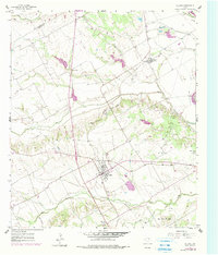
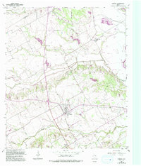
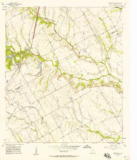
Editions of this 1957 Chilton Map
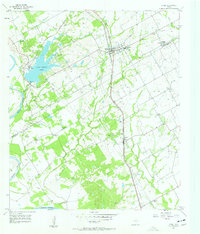
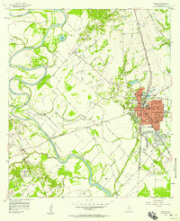
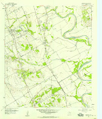
Other maps of this area

1892 · Temple
USGS Topo · 1:125,000

1954 · Waco
USGS Topo · 1:250,000

1955 · Waco
USGS Topo · 1:250,000
1957 · Bruceville
USGS Topo · 1:24,000
1957 · Lorena
USGS Topo · 1:24,000
1957 · Riesel
USGS Topo · 1:24,000
1957 · Marlin
USGS Topo · 1:24,000
1957 · Robinson
USGS Topo · 1:24,000
1962 · Cedar Springs
USGS Topo · 1:24,000
1963 · Lott
USGS Topo · 1:24,000