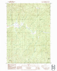
1986 Map of Cedar Springs Mtn
USGS Topo · Published 1986About this map
Umpqua National Forest defines the heavily dissected landscape of this 1986 survey, where the border between Douglas Co and Jackson Co traverses the southern ridges. The drainage patterns are intricate, dominated by Cow Creek and its many tributaries, including Snow Creek, Meadow Creek, and the aptly named Dismal Creek. Isolated outposts of human activity are sparse, represented by Koch Ranch and Devils Flat, while the higher elevations are marked by distinctive peaks such as Cedar Springs Mtn, Red Mountain with its Lookout House, and the prominent Castle Rock. In the northern reaches, The Meadows provides a rare break in the timbered terrain near the banks of Cow Creek. This map is a significant record of the forest's interior before modern developments, showing the reliance on 4wd tracks and primitive routes to access remote areas like Ike Butte and Green Butte.
Find a feature on this map
37 named features on this map. Tap any name to fly to it.
Don’t see what you’re looking for? This feature index may not catch every label — zoom into the map to look around manually.
Map Details
Editions of this 1986 Cedar Springs Mtn Map
This is the sole edition of this map. No revisions or reprints were ever made.
Other maps of this area

1891 · Ashland
USGS Topo · 1:250,000

1893 · Ashland
USGS Topo · 1:250,000

1897 · Ashland
USGS Topo · 1:250,000

1904 · Riddle
USGS Topo · 1:125,000

1943 · Trail
USGS Topo · 1:62,500

1944 · Tiller
USGS Topo · 1:62,500

1954 · Days Creek
USGS Topo · 1:62,500

1954 · Wimer
USGS Topo · 1:62,500

1955 · Medford
USGS Topo · 1:250,000

1957 · Medford
USGS Topo · 1:250,000