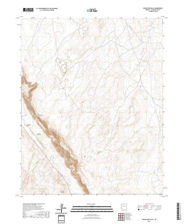
2021 Map of Cedar Tree Hills
USGS Topo · Published 2021About this map
Echo Cliffs dominate the western portion of this Coconino County terrain, creating a dramatic escarpment that defines the local geography. This high-desert landscape is characterized by prominent elevations such as North Red Hill, South Red Hill, and the eponymous Cedar Tree Hills. The drainage patterns are clearly marked by the winding paths of Curve Wash and Tanner Wash, which navigate the varying topography of Cornfield Valley. Highway 89 runs through the southwestern section, providing a primary transportation corridor near the cliff line. The map detail reflects the township and range divisions of T37N R7E and T36N R8E, illustrating the systematic land partitioning used by the U.S. Geological Survey in this part of Arizona.
Find a feature on this map
13 named features on this map. Tap any name to fly to it.
Don’t see what you’re looking for? This feature index may not catch every label — zoom into the map to look around manually.
Map Details
Editions of this 2021 Cedar Tree Hills Map
This is the sole edition of this map. No revisions or reprints were ever made.
Other maps of this area

1886 · Echo Cliffs
USGS Topo · 1:250,000

1891 · Echo Cliffs
USGS Topo · 1:250,000

1954 · Shinumo Altar NE
USGS Topo · 1:24,000

1954 · Tanner Wash
USGS Topo · 1:62,500

1954 · Shinumo Altar
USGS Topo · 1:62,500

1955 · Tanner Wash NE
USGS Topo · 1:24,000

1956 · Marble Canyon
USGS Topo · 1:250,000

1959 · Marble Canyon
USGS Topo · 1:250,000

1961 · Marble Canyon
USGS Topo · 1:250,000
1982 · Toh Bih Nosteny
USGS Topo · 1:24,000