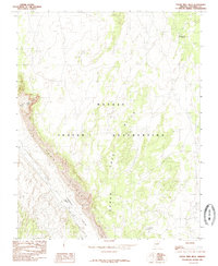
1985 Map of Cedar Tree Hills
USGS Topo · Published 1985About this map
The Navajo Indian Reservation landscape is defined by the striking descent of the Echo Cliffs, which separate the higher plateau from the broad drainage of Cornfield Valley. This 1985 survey, produced as a provisional map from late-1970s field data, captures a transition in topography where the Cedar Tree Hills rise above the surrounding terrain. Notable local landmarks like Whistling Curve and Wind Wash indicate the named geographical features used by those navigating this part of Coconino County. The presence of Locoweed Pond and the elevations marked at Porcupine Mesa provide specific points of reference for researchers and surveyors working within the reservation's high-desert environment during the late twentieth century.
Find a feature on this map
9 named features on this map. Tap any name to fly to it.
Don’t see what you’re looking for? This feature index may not catch every label — zoom into the map to look around manually.
Map Details
Editions of this 1985 Cedar Tree Hills Map
This is the sole edition of this map. No revisions or reprints were ever made.
Other maps of this area

1886 · Echo Cliffs
USGS Topo · 1:250,000

1891 · Echo Cliffs
USGS Topo · 1:250,000

1954 · Shinumo Altar NE
USGS Topo · 1:24,000

1954 · Tanner Wash
USGS Topo · 1:62,500

1954 · Shinumo Altar
USGS Topo · 1:62,500

1955 · Tanner Wash NE
USGS Topo · 1:24,000

1956 · Marble Canyon
USGS Topo · 1:250,000

1959 · Marble Canyon
USGS Topo · 1:250,000

1961 · Marble Canyon
USGS Topo · 1:250,000
1982 · Toh Bih Nosteny
USGS Topo · 1:24,000