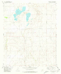
1981 Map of Cedarvale NE
USGS Topo · Published 1981About this map
Salt flats and ephemeral basins dominate the northern terrain of this 1981 Torrance County landscape, where the arid high-desert environment is punctuated only by vital water sources like localized Springs. The mapping reveals a sparse settlement pattern characteristic of this portion of New Mexico, centered on the Going Thing Ranch. Beyond the livestock operations, the presence of a Drill Hole and a scattered Well indicate the ongoing human efforts to tap into subsurface resources in a region otherwise defined by its undulating topography and saline depressions. The map serves as a detailed record of land use and water management in a demanding environment during the early 1980s.
Find a feature on this map
6 named features on this map. Tap any name to fly to it.
Don’t see what you’re looking for? This feature index may not catch every label — zoom into the map to look around manually.
Map Details
Editions of this 1981 Cedarvale NE Map
This is the sole edition of this map. No revisions or reprints were ever made.
Other maps of this area

1954 · Fort Sumner
USGS Topo · 1:250,000

1958 · Fort Sumner
USGS Topo · 1:250,000

1978 · Negra SW
USGS Topo · 1:24,000

1978 · Negra SE
USGS Topo · 1:24,000

1978 · Dunlap Ranch
USGS Topo · 1:24,000

1980 · Corona
USGS Topo · 1:100,000

1981 · Pino Mountain
USGS Topo · 1:24,000

1981 · Camaleon Draw West
USGS Topo · 1:24,000
1981 · Duran
USGS Topo · 1:24,000
1981 · Corona North
USGS Topo · 1:24,000