
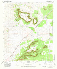
1978 Map of Negra SE
USGS Topo · Published 1978About this map
Large basins and distinct Depression features define this corner of Torrance County in the late 1970s. The landscape is primarily a series of wide, shallow natural catchments, with the topography carefully tracked by the Geological Survey. Human infrastructure is sparse here, limited to a single Pipeline that cuts across the northern terrain and an established network of fences. The map documents the boundary between Township 5 North and Township 4 North, illustrating how the open range was partitioned for grazing or mineral rights while remaining largely undeveloped. This 1978 edition provides a look at the arid New Mexico interior just after field checks were completed in 1975, showing the region before modern land use changes.
Find a feature on this map
6 named features on this map. Tap any name to fly to it.
Don’t see what you’re looking for? This feature index may not catch every label — zoom into the map to look around manually.
Map Details
Editions of this 1978 Negra SE Map
This is the sole edition of this map. No revisions or reprints were ever made.
Other maps of this area

1954 · Fort Sumner
USGS Topo · 1:250,000

1958 · Fort Sumner
USGS Topo · 1:250,000

1978 · Negra SW
USGS Topo · 1:24,000

1978 · Pedernal
USGS Topo · 1:24,000

1978 · Encino
USGS Topo · 1:24,000

1978 · Negra
USGS Topo · 1:24,000

1978 · Dunlap Ranch
USGS Topo · 1:24,000

1980 · Corona
USGS Topo · 1:100,000

1981 · Pino Mountain
USGS Topo · 1:24,000
1981 · Duran
USGS Topo · 1:24,000