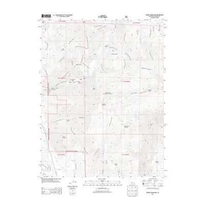
2013 Map of Cement Mountain
USGS Topo · Published 2013About this map
Cement Mountain and its eastern neighbor, East Cement Mountain, dominate this high-altitude landscape within the Gunnison National Forest. The map documents a rugged interior defined by a network of drainage basins including Horse Basin and Granite Basin, alongside numerous named gulches like Deadman Gulch and Walrod Gulch. Human presence is concentrated primarily along the watercourses, notably where the Cement Creek Forest Service Facility and the Cement Creek Campground sit near the seasonal residences of the Cement Summer Home Group. The presence of Cement Creek Hot Spring and Cement Creek Spring highlights the geothermal and hydrologic character of the region. A complex system of forest trails, such as the Doubletop Trail and Bear Creek Trail, provides the primary means of navigating the steep grades between summits like Strand Hill and Round Mountain.
Find a feature on this map
62 named features on this map. Tap any name to fly to it.
Don’t see what you’re looking for? This feature index may not catch every label — zoom into the map to look around manually.
Map Details
Editions of this 2013 Cement Mountain Map
This is the sole edition of this map. No revisions or reprints were ever made.
Other maps of this area

1888 · Crested Butte
USGS Topo · 1:62,500

1889 · Crested Butte
USGS Topo · 1:62,500

1893 · Crested Butte
USGS Topo · 1:62,500

1934 · Taylor Park
USGS Topo · 1:62,500

1937 · Taylor Park
USGS Topo · 1:62,500

1941 · Pitkin
USGS Topo · 1:62,500

1945 · Pitkin
USGS Topo · 1:62,500

1956 · Montrose
USGS Topo · 1:250,000

1959 · Montrose
USGS Topo · 1:250,000

1960 · Montrose
USGS Topo · 1:250,000