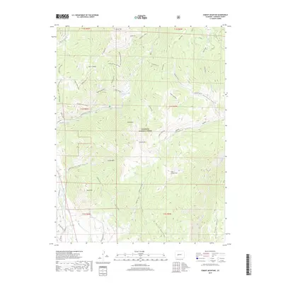
2019 Map of Cement Mountain
USGS Topo · Published 2019About this map
Gunnison National Forest dominates this high-elevation landscape, where geothermal activity and complex drainage patterns define the local geography. The Cement Creek Hot Spring sits near the confluence of several mountain drainages, highlighting the area's natural geological features. The terrain is marked by significant peaks such as Cement Mountain, East Cement Mtn, and the distinctive Double Top, with deep cuts from Deadman Gulch and Walrod Gulch shaping the watershed. A network of specialized routes like the Waterfall Cutoff and Farris Creek Bypass indicates a landscape primarily utilized for forest management and remote access. The proximity of Roaring Judy and various gulches named for local figures or characteristics suggests a history of small-scale prospecting or seasonal grazing within the high basins of the Colorado Rockies.
Find a feature on this map
54 named features on this map. Tap any name to fly to it.
Don’t see what you’re looking for? This feature index may not catch every label — zoom into the map to look around manually.
Map Details
Editions of this 2019 Cement Mountain Map
This is the sole edition of this map. No revisions or reprints were ever made.
Other maps of this area

1888 · Crested Butte
USGS Topo · 1:62,500

1889 · Crested Butte
USGS Topo · 1:62,500

1893 · Crested Butte
USGS Topo · 1:62,500

1934 · Taylor Park
USGS Topo · 1:62,500

1937 · Taylor Park
USGS Topo · 1:62,500

1941 · Pitkin
USGS Topo · 1:62,500

1945 · Pitkin
USGS Topo · 1:62,500

1956 · Montrose
USGS Topo · 1:250,000

1959 · Montrose
USGS Topo · 1:250,000

1960 · Montrose
USGS Topo · 1:250,000