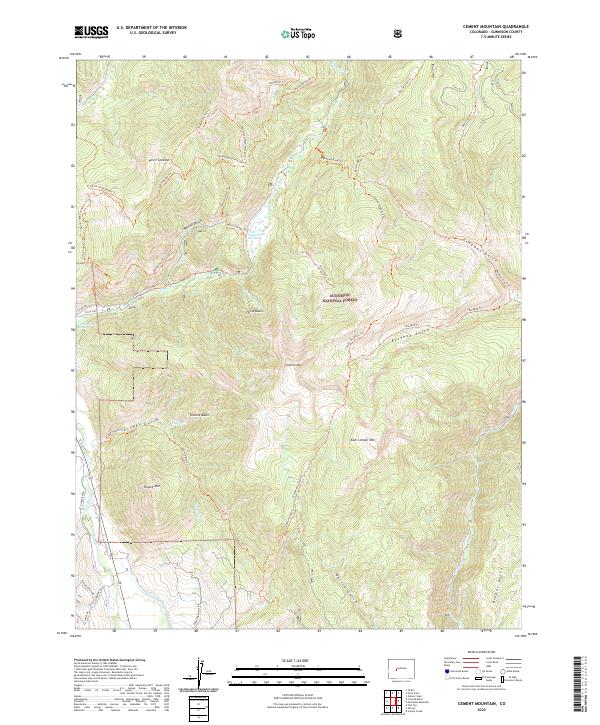
2022 Map of Cement Mountain
USGS Topo · Published 2022About this map
Gunnison National Forest dominates this high-altitude landscape, where the headwaters of Cement Creek and the East River carve through a network of steep gulches and prominent peaks. The map details a complex system of historical trails and modern forest roads, including the Reno Ridge Trail and Deadman Gulch Trail, which navigate the elevation between Point Lookout and Cement Mountain.
Find a feature on this map
55 named features on this map. Tap any name to fly to it.
Don’t see what you’re looking for? This feature index may not catch every label — zoom into the map to look around manually.
Map Details
Editions of this 2022 Cement Mountain Map
This is the sole edition of this map. No revisions or reprints were ever made.
Other maps of this area

1888 · Crested Butte
USGS Topo · 1:62,500

1889 · Crested Butte
USGS Topo · 1:62,500

1893 · Crested Butte
USGS Topo · 1:62,500

1934 · Taylor Park
USGS Topo · 1:62,500

1937 · Taylor Park
USGS Topo · 1:62,500

1941 · Pitkin
USGS Topo · 1:62,500

1945 · Pitkin
USGS Topo · 1:62,500

1956 · Montrose
USGS Topo · 1:250,000

1959 · Montrose
USGS Topo · 1:250,000

1960 · Montrose
USGS Topo · 1:250,000