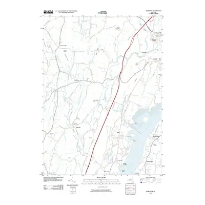
2010 Map of Cementon
USGS Topo · Published 2010About this map
The Hudson River dominates the eastern landscape of this 2010 survey, serving as the primary geographic anchor for riverside settlements like Cementon, Smith Landing, and Cheviot. The western interior is characterized by a mix of agricultural and recreational land use, featuring Pathfinder Farms, Sunrise Farms, and youth retreats such as Camp On-Ti-Ora and Camp Rip Van Winkle. The terrain transitions from the low-lying Kiskatom Flats toward the prominent Bethel Ridge and Vedder Mountain.
Find a feature on this map
94 named features on this map. Tap any name to fly to it.
Don’t see what you’re looking for? This feature index may not catch every label — zoom into the map to look around manually.
Map Details
Editions of this 2010 Cementon Map
This is the sole edition of this map. No revisions or reprints were ever made.
Other maps of this area

1892 · Kaaterskill
USGS Topo · 1:62,500

1893 · Kaaterskill
USGS Topo · 1:62,500

1893 · Coxsackie
USGS Topo · 1:62,500

1893 · Durham
USGS Topo · 1:62,500

1894 · Coxsackie
USGS Topo · 1:62,500

1894 · Kaaterskill
USGS Topo · 1:62,500

1894 · Durham
USGS Topo · 1:62,500

1895 · Catskill
USGS Topo · 1:62,500

1899 · Kaaterskill
USGS Topo · 1:62,500

1903 · Kaaterskill
USGS Topo · 1:62,500