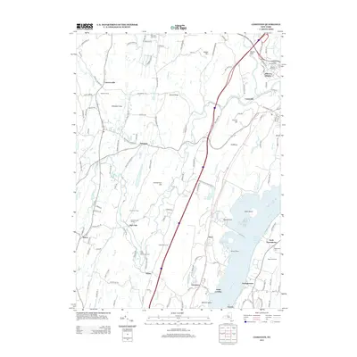
2013 Map of Cementon
USGS Topo · Published 2013About this map
The Hudson River corridor near the Ulster and Greene County line defines this landscape, where the river's eastern banks meet the varied terrain of the Kalkberg and Bethel Ridge. This 2013 survey illustrates the area's agricultural and recreational character, featuring specialized sites like Wagar Orchards and Cody Creek Community Farm alongside established youth camps such as Camp On-Ti-Ora and Camp Rip Van Winkle. The industrial and maritime legacy of the river is evident at Cementon, Alsen, and Smith Landing, while the northern reach shows the growing residential footprint of Jefferson Heights.
Find a feature on this map
141 named features on this map. Tap any name to fly to it.
Don’t see what you’re looking for? This feature index may not catch every label — zoom into the map to look around manually.
Map Details
Editions of this 2013 Cementon Map
This is the sole edition of this map. No revisions or reprints were ever made.
Other maps of this area

1892 · Kaaterskill
USGS Topo · 1:62,500

1893 · Kaaterskill
USGS Topo · 1:62,500

1893 · Coxsackie
USGS Topo · 1:62,500

1893 · Durham
USGS Topo · 1:62,500

1894 · Coxsackie
USGS Topo · 1:62,500

1894 · Kaaterskill
USGS Topo · 1:62,500

1894 · Durham
USGS Topo · 1:62,500

1895 · Catskill
USGS Topo · 1:62,500

1899 · Kaaterskill
USGS Topo · 1:62,500

1903 · Kaaterskill
USGS Topo · 1:62,500