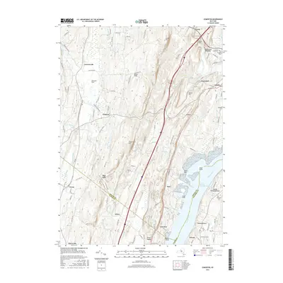
2016 Map of Cementon
USGS Topo · Published 2016About this map
The Hudson River dominates this landscape as it flows through the North German Town Reach, passing industrial and residential corridors at Cementon and North Germantown. This stretch of the river is defined by significant landmarks like Dewitt Point, Bush Island, and Wanton Island, which sit opposite the expansive wetlands of the Great Vly. The corridor reflects centuries of activity, with older settlements like Leeds and Catskill tucked into the northern edge near Jefferson Heights.
Find a feature on this map
119 named features on this map. Tap any name to fly to it.
Don’t see what you’re looking for? This feature index may not catch every label — zoom into the map to look around manually.
Map Details
Editions of this 2016 Cementon Map
This is the sole edition of this map. No revisions or reprints were ever made.
Other maps of this area

1892 · Kaaterskill
USGS Topo · 1:62,500

1893 · Kaaterskill
USGS Topo · 1:62,500

1893 · Coxsackie
USGS Topo · 1:62,500

1893 · Durham
USGS Topo · 1:62,500

1894 · Coxsackie
USGS Topo · 1:62,500

1894 · Kaaterskill
USGS Topo · 1:62,500

1894 · Durham
USGS Topo · 1:62,500

1895 · Catskill
USGS Topo · 1:62,500

1899 · Kaaterskill
USGS Topo · 1:62,500

1903 · Kaaterskill
USGS Topo · 1:62,500