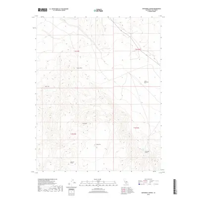
2018 Map of Centennial Canyon
USGS Topo · Published 2018About this map
The Coso Range dominates this landscape, where steep drainage systems carve through the high desert of Inyo County. This 2018 survey captures the intersection of several distinct geological basins, including Joshua Flat and Lower Centennial Flat, which collect runoff from the surrounding peaks. The topography is defined by significant landmarks such as Sugar Loaf and the deep incisions of Centennial Canyon and Vermillion Canyon. A critical water source in this arid environment is recorded at Lower Centennial Spring, providing a vital point of interest for those studying the natural history and survival routes of the northern Mojave Desert. The map is particularly useful for visualizing the complex relief and elevation changes that define this portion of the California desert.
Find a feature on this map
12 named features on this map. Tap any name to fly to it.
Don’t see what you’re looking for? This feature index may not catch every label — zoom into the map to look around manually.
Map Details
Editions of this 2018 Centennial Canyon Map
This is the sole edition of this map. No revisions or reprints were ever made.
Other maps of this area

1908 · Ballarat
USGS Topo · 1:250,000

1913 · Ballarat
USGS Topo · 1:250,000

1948 · Death Valley
USGS Topo · 1:250,000

1950 · Darwin
USGS Topo · 1:62,500

1951 · Darwin
USGS Topo · 1:62,500

1951 · Keeler
USGS Topo · 1:62,500

1951 · Haiwee Reservoir
USGS Topo · 1:62,500

1951 · Coso Peak
USGS Topo · 1:62,500

1954 · Death Valley
USGS Topo · 1:250,000

1956 · Death Valley
USGS Topo · 1:250,000