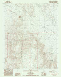
1987 Map of Centennial Canyon
USGS Topo · Published 1987About this map
Coso Range topography dominates this 1980s landscape, where steep slopes transition into the expansive Joshua Flat and Centennial Flat. This area of Inyo County reveals a history of land use focused on livestock and mining, indicated by the presence of Ninemile Corral and various scattered prospects and claypits. The geography is defined by significant drainage systems, most notably Centennial Canyon which cuts through the southern portion of the sheet.
Find a feature on this map
15 named features on this map. Tap any name to fly to it.
Don’t see what you’re looking for? This feature index may not catch every label — zoom into the map to look around manually.
Map Details
Editions of this 1987 Centennial Canyon Map
This is the sole edition of this map. No revisions or reprints were ever made.
Other maps of this area

1908 · Ballarat
USGS Topo · 1:250,000

1913 · Ballarat
USGS Topo · 1:250,000

1948 · Death Valley
USGS Topo · 1:250,000

1950 · Darwin
USGS Topo · 1:62,500

1951 · Darwin
USGS Topo · 1:62,500

1951 · Keeler
USGS Topo · 1:62,500

1951 · Haiwee Reservoir
USGS Topo · 1:62,500

1951 · Coso Peak
USGS Topo · 1:62,500

1954 · Death Valley
USGS Topo · 1:250,000

1956 · Death Valley
USGS Topo · 1:250,000