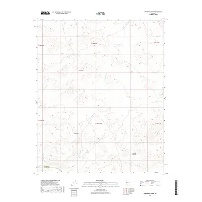
2018 Map of Centennial Wash
USGS Topo · Published 2018About this map
The Bill Williams River defines the southern boundary of this arid landscape, where the Mohave and La Paz county line marks the edge of the Mojave Desert. The map reveals a land structured by drainage and elevation, dominated by the winding course of the Centennial Wash as it carves through the region's prominent geologic features. To the south, the Rawhide Mountains rise sharply, while the central portion is anchored by the high plateau of Black Mesa. This environment is a study in natural boundaries and topographic relief, showing how the seasonal waters of the wash and the more permanent flow of the river have shaped the desert floor. To the northeast, the isolated depression of Ester Basin provides another distinct geographical marker in this undeveloped portion of western Arizona.
Find a feature on this map
13 named features on this map. Tap any name to fly to it.
Don’t see what you’re looking for? This feature index may not catch every label — zoom into the map to look around manually.
Map Details
Editions of this 2018 Centennial Wash Map
This is the sole edition of this map. No revisions or reprints were ever made.
Other maps of this area

1923 · Signal
USGS Topo · 1:250,000

1942 · Signal
USGS Topo · 1:250,000

1950 · Prescott
USGS Topo · 1:250,000

1954 · Prescott
USGS Topo · 1:250,000

1958 · Prescott
USGS Topo · 1:250,000

1959 · Prescott
USGS Topo · 1:250,000

1960 · Prescott
USGS Topo · 1:250,000

1965 · Prescott
USGS Topo · 1:250,000
1966 · Swansea
USGS Topo · 1:62,500

1966 · Ives Peak
USGS Topo · 1:62,500