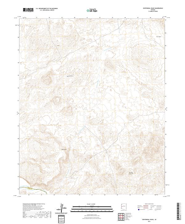
2021 Map of Centennial Wash
USGS Topo · Published 2021About this map
Centennial Wash winds through a landscape of high desert mesas and mountain ranges at the transition between the Mojave Desert and the rugged interior of Arizona. This modern survey illustrates the sparse, drainage-defined topography of the region where the Mohave and La Paz county lines meet. The terrain is dominated by the volcanic profile of Black Mesa and the jagged ridges of the Rawhide Mountains, providing a detailed view of the natural barriers that have historically dictated movement through this arid corridor.
Find a feature on this map
7 named features on this map. Tap any name to fly to it.
Don’t see what you’re looking for? This feature index may not catch every label — zoom into the map to look around manually.
Map Details
Editions of this 2021 Centennial Wash Map
This is the sole edition of this map. No revisions or reprints were ever made.
Other maps of this area

1923 · Signal
USGS Topo · 1:250,000

1942 · Signal
USGS Topo · 1:250,000

1950 · Prescott
USGS Topo · 1:250,000

1954 · Prescott
USGS Topo · 1:250,000

1958 · Prescott
USGS Topo · 1:250,000

1959 · Prescott
USGS Topo · 1:250,000

1960 · Prescott
USGS Topo · 1:250,000

1965 · Prescott
USGS Topo · 1:250,000
1966 · Swansea
USGS Topo · 1:62,500

1966 · Ives Peak
USGS Topo · 1:62,500