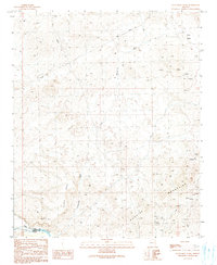
1990 Map of Centennial Wash
USGS Topo · Published 1990About this map
The Rawhide Mountains dominate the landscape of this northwest Arizona survey, rising above the deep drainage of Centennial Wash. In the early 1990s, this area remained largely undeveloped, characterized by isolated outposts like Fisher Camp and the small settlement of Hughes near the southern boundary. The northern reaches are marked by Ester Basin and a series of extractive sites including a Drill Hole and several prospects, signaling the region's long-standing connection to mineral exploration.
Find a feature on this map
21 named features on this map. Tap any name to fly to it.
Don’t see what you’re looking for? This feature index may not catch every label — zoom into the map to look around manually.
Map Details
Editions of this 1990 Centennial Wash Map
This is the sole edition of this map. No revisions or reprints were ever made.
Other maps of this area

1923 · Signal
USGS Topo · 1:250,000

1942 · Signal
USGS Topo · 1:250,000

1950 · Prescott
USGS Topo · 1:250,000

1954 · Prescott
USGS Topo · 1:250,000

1958 · Prescott
USGS Topo · 1:250,000

1959 · Prescott
USGS Topo · 1:250,000

1960 · Prescott
USGS Topo · 1:250,000

1965 · Prescott
USGS Topo · 1:250,000
1966 · Swansea
USGS Topo · 1:62,500

1966 · Ives Peak
USGS Topo · 1:62,500