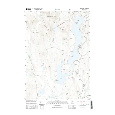
2014 Map of Center Lovell
USGS Topo · Published 2014About this map
The eastern edge of the White Mountain National Forest dominates the high ground here, where ridges like Adams Mountain and Stiles Mountain overlook a complex network of glacial ponds and drainages. The landscape is defined by the massive reach of Kezar Lake, including its central constriction at The Narrows and the prominent Timber Island. The settlement pattern follows the lake's eastern shore and the surrounding valleys, with established communities at Center Lovell, Lovell, and Stow. Genealogists will find a significant number of family and community burial sites, from the North Lovell Cem near Birch Island down to the Bemis Cem and Village Cem in the south. The transition from the steep peaks of the forest to the agricultural openings at The Plains illustrates the dual nature of Oxford County’s economy, balancing timberlands with lowland valley farming along the Old Course Saco River.
Find a feature on this map
138 named features on this map. Tap any name to fly to it.
Don’t see what you’re looking for? This feature index may not catch every label — zoom into the map to look around manually.
Map Details
Editions of this 2014 Center Lovell Map
This is the sole edition of this map. No revisions or reprints were ever made.
Other maps of this area

1893 · Gorham
USGS Topo · 1:62,500

1894 · North Conway
USGS Topo · 1:62,500

1896 · North Conway
USGS Topo · 1:62,500

1896 · Gorham
USGS Topo · 1:62,500

1909 · Fryeburg
USGS Topo · 1:62,500

1911 · Fryeburg
USGS Topo · 1:62,500

1914 · Bethel
USGS Topo · 1:62,500

1937 · Gorham
USGS Topo · 1:48,000

1940 · Bethel
USGS Topo · 1:62,500

1941 · Bethel
USGS Topo · 1:62,500