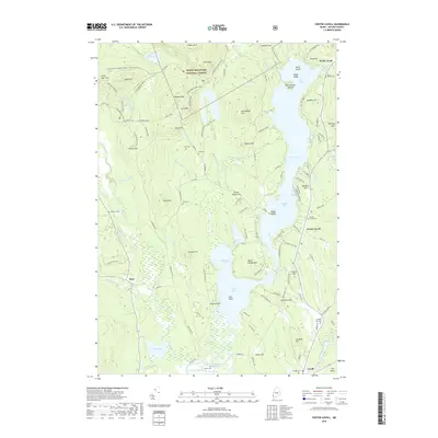
2018 Map of Center Lovell
USGS Topo · Published 2018About this map
White Mountain National Forest dominates the western topography of this Oxford County region, where the rugged slopes of Deer Hill and Harndon Hill descend toward the fertile basins of the Cold River and Kezar Lake. The settlement pattern follows the contours of the water, with the village of Center Lovell overlooking Middle Bay and Lower Bay. This landscape is marked by a significant concentration of family and community burial grounds, including the Lord Cem, Fox Cem, and Number Four Cem, which provide essential touchpoints for genealogical research in this part of Maine. Along the southern edge, the Old Course Saco River and Fryeburg Harbor indicate the historical importance of the river systems. The inclusion of numerous snowmobile trails like the Evans Notch Snomo Corr19/ITS80 highlights the modern intersection of these traditional rural lands with contemporary recreational use.
Find a feature on this map
134 named features on this map. Tap any name to fly to it.
Don’t see what you’re looking for? This feature index may not catch every label — zoom into the map to look around manually.
Map Details
Editions of this 2018 Center Lovell Map
This is the sole edition of this map. No revisions or reprints were ever made.
Other maps of this area

1893 · Gorham
USGS Topo · 1:62,500

1894 · North Conway
USGS Topo · 1:62,500

1896 · North Conway
USGS Topo · 1:62,500

1896 · Gorham
USGS Topo · 1:62,500

1909 · Fryeburg
USGS Topo · 1:62,500

1911 · Fryeburg
USGS Topo · 1:62,500

1914 · Bethel
USGS Topo · 1:62,500

1937 · Gorham
USGS Topo · 1:48,000

1940 · Bethel
USGS Topo · 1:62,500

1941 · Bethel
USGS Topo · 1:62,500