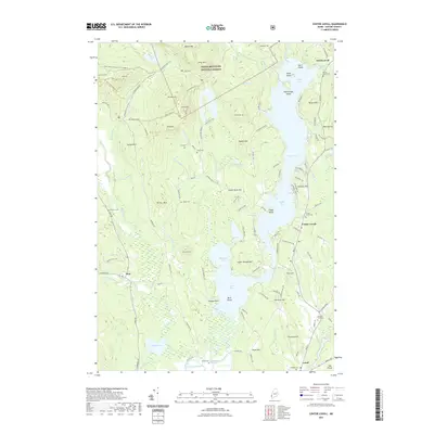
2021 Map of Center Lovell
USGS Topo · Published 2021About this map
White Mountain National Forest dominates the western landscape of this Oxford County region, where the steep elevations of Stiles Mtn and Adams Mtn give way to the complex water systems of the Kezar River valley. The map reveals a deeply rooted rural community organized around the long, irregular shores of Kezar Lake, from North Lovell down through Center Lovell to the southern settlement of Lovell. This area is particularly rich in genealogical markers, preserving numerous small burial grounds such as Smith Cem, Fox Cem, and Number Four Cem that dot the hillsides between the water and the forest boundary. The southeastern corner shows the transition to the The Plains near Fryeburg Harbor, while the western edge captures the isolated settlement of Stow along the Cold River, illustrating how the region's early development followed the narrow habitable corridors between significant peaks like Wiley Mtn and Colton Hill.
Find a feature on this map
146 named features on this map. Tap any name to fly to it.
Don’t see what you’re looking for? This feature index may not catch every label — zoom into the map to look around manually.
Map Details
Editions of this 2021 Center Lovell Map
This is the sole edition of this map. No revisions or reprints were ever made.
Other maps of this area

1893 · Gorham
USGS Topo · 1:62,500

1894 · North Conway
USGS Topo · 1:62,500

1896 · North Conway
USGS Topo · 1:62,500

1896 · Gorham
USGS Topo · 1:62,500

1909 · Fryeburg
USGS Topo · 1:62,500

1911 · Fryeburg
USGS Topo · 1:62,500

1914 · Bethel
USGS Topo · 1:62,500

1937 · Gorham
USGS Topo · 1:48,000

1940 · Bethel
USGS Topo · 1:62,500

1941 · Bethel
USGS Topo · 1:62,500