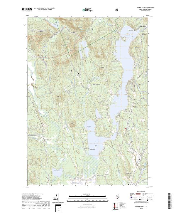
2024 Map of Center Lovell
USGS Topo · Published 2024About this map
White Mountain National Forest dominates the western highlands of this Oxford County landscape, where the terrain drops sharply toward the intricate shoreline of Kezar Lake. The lake is the central geographic feature, divided into an Upper Bay, Middle Bay, and Lower Bay by landforms like Ladies Delight Hill and Timber Island. This configuration created a natural focus for seasonal and year-round settlement, visible in the clusters at North Lovell, Center Lovell, and Lovell.
Find a feature on this map
145 named features on this map. Tap any name to fly to it.
Don’t see what you’re looking for? This feature index may not catch every label — zoom into the map to look around manually.
Map Details
Editions of this 2024 Center Lovell Map
This is the sole edition of this map. No revisions or reprints were ever made.
Other maps of this area

1893 · Gorham
USGS Topo · 1:62,500

1894 · North Conway
USGS Topo · 1:62,500

1896 · North Conway
USGS Topo · 1:62,500

1896 · Gorham
USGS Topo · 1:62,500

1909 · Fryeburg
USGS Topo · 1:62,500

1911 · Fryeburg
USGS Topo · 1:62,500

1914 · Bethel
USGS Topo · 1:62,500

1937 · Gorham
USGS Topo · 1:48,000

1940 · Bethel
USGS Topo · 1:62,500

1941 · Bethel
USGS Topo · 1:62,500