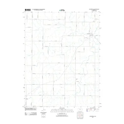
2012 Map of Centerville
USGS Topo · Published 2012About this map
Centerville serves as the primary hub of this rural Linn County landscape, where the local post office and street grid sit near the banks of Saline Cr. The terrain is defined by the winding paths of Sugar Cr and its S Fork Sugar Cr, which dictate the irregular patterns of local roads like Botkin Rd and Cassida Rd. Beyond the main settlement, smaller community markers such as Selma and Vance appear along the section lines, reflecting the enduring agricultural footprint of eastern Kansas. Genealogists and local historians can locate Oakwood Cem positioned along the roadway south of the central township. This 2012 survey captures the area’s transition from early pioneer routes to a structured network of rural delivery roads, preserving the names of family-landmarked thoroughfares such as Dingus Rd and Arthur Rd.
Find a feature on this map
49 named features on this map. Tap any name to fly to it.
Don’t see what you’re looking for? This feature index may not catch every label — zoom into the map to look around manually.
Map Details
Editions of this 2012 Centerville Map
This is the sole edition of this map. No revisions or reprints were ever made.
Other maps of this area

1885 · Garnett
USGS Topo · 1:125,000

1887 · Mound City
USGS Topo · 1:125,000

1893 · Mound City
USGS Topo · 1:125,000

1894 · Garnett
USGS Topo · 1:125,000

1947 · Lawrence
USGS Topo · 1:250,000

1950 · Lawrence
USGS Topo · 1:250,000

1956 · Lawrence
USGS Topo · 1:250,000

1961 · Lawrence
USGS Topo · 1:250,000

1963 · Parker
USGS Topo · 1:24,000
1966 · Mound City NW
USGS Topo · 1:24,000