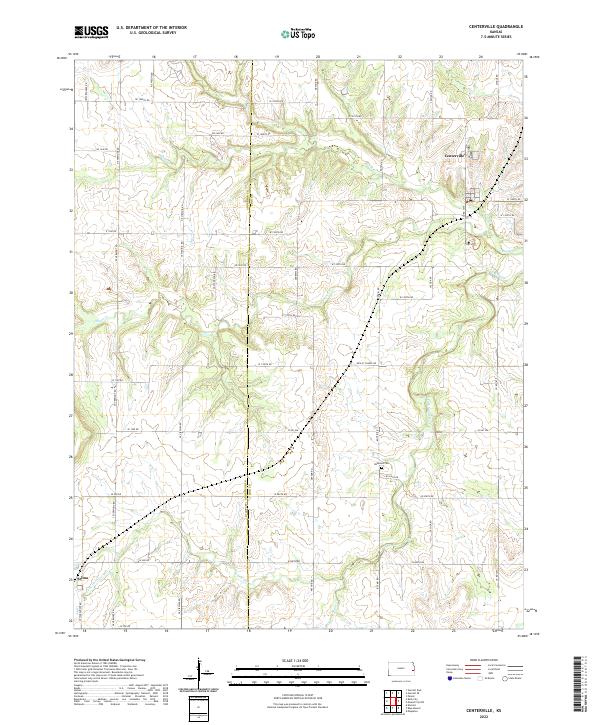
2022 Map of Centerville
USGS Topo · Published 2022About this map
Centerville and Selma anchor the landscape along the Anderson County and Linn County line, reflecting the organized sectional development of the Kansas prairie. The drainage system of Sugar Creek and its tributaries, including South Fork Sugar Creek and Saline Creek, dictates the undulating terrain. A dense network of township and range roads, such as Arthur Road and Cassida Road, connects the rural homesteads to the central community hubs. Near the southern edge of the survey, Selma sits near the headwaters of Little Gus Creek, while the presence of the Oakwood Cemetery to the east provides a tangible link to the area's early settlement history. The map also indicates the location of a Post Office in Centerville, a critical point of connectivity for this rural agricultural district.
Find a feature on this map
52 named features on this map. Tap any name to fly to it.
Don’t see what you’re looking for? This feature index may not catch every label — zoom into the map to look around manually.
Map Details
Editions of this 2022 Centerville Map
This is the sole edition of this map. No revisions or reprints were ever made.
Other maps of this area

1885 · Garnett
USGS Topo · 1:125,000

1887 · Mound City
USGS Topo · 1:125,000

1893 · Mound City
USGS Topo · 1:125,000

1894 · Garnett
USGS Topo · 1:125,000

1947 · Lawrence
USGS Topo · 1:250,000

1950 · Lawrence
USGS Topo · 1:250,000

1956 · Lawrence
USGS Topo · 1:250,000

1961 · Lawrence
USGS Topo · 1:250,000

1963 · Parker
USGS Topo · 1:24,000
1966 · Mound City NW
USGS Topo · 1:24,000