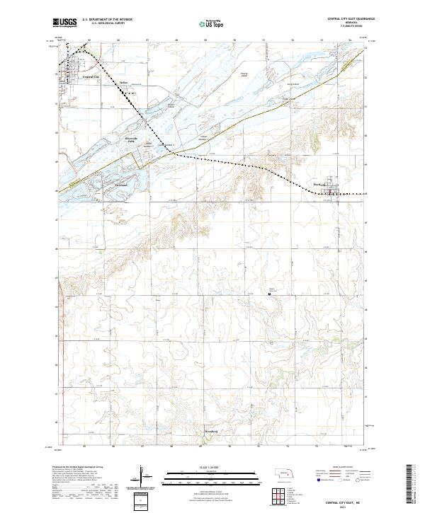
2021 Map of Central City East
USGS Topo · Published 2021About this map
The Platte River corridor dominates this map, characterized by an intricate network of named islands like Prairie Island and Parker Island. The city of Central City, anchored by the Merrick County Courthouse, serves as a primary hub where the Union Pacific railroad line intersects with the local street grid. The landscape south of the river transitions into a more rural grid of section roads, where smaller settlements like Hordville, Overland, and Kronborg are situated. This area marks a hydrologic divide, showing the headwaters of the Big Blue River flowing south while the Platte continues its braided course to the northeast. Cultural markers such as Mount Zion Cem and Riverside Park provide specific points of interest for genealogists and local historians tracking the development of Merrick and Hamilton counties.
Find a feature on this map
68 named features on this map. Tap any name to fly to it.
Don’t see what you’re looking for? This feature index may not catch every label — zoom into the map to look around manually.
Map Details
Editions of this 2021 Central City East Map
This is the sole edition of this map. No revisions or reprints were ever made.
Other maps of this area

1896 · Stromsburg
USGS Topo · 1:125,000

1898 · York
USGS Topo · 1:125,000

1898 · Grand Island
USGS Topo · 1:125,000

1899 · St. Paul
USGS Topo · 1:125,000

1899 · York
USGS Topo · 1:125,000

1955 · Broken Bow
USGS Topo · 1:250,000

1955 · Fremont
USGS Topo · 1:250,000

1955 · Lincoln
USGS Topo · 1:250,000

1955 · Grand Island
USGS Topo · 1:250,000

1956 · Broken Bow
USGS Topo · 1:250,000