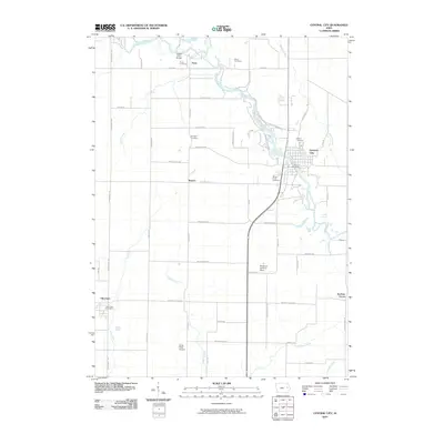
2010 Map of Central City
USGS Topo · Published 2010About this map
The Wapsipinicon River meanders through this Linn County landscape, serving as a central geographic anchor for settlements like Central City and the smaller community of Paris. The land use is defined by a dense grid of rural roads and scattered small-scale aviation sites, such as the Wassmer Landing Strip and Petes Patch Airport. For those tracing local heritage, the map identifies several distinct burial grounds, including Mills Cemetery and Blodgett Cemetery, which are often the only remaining markers of early family homesteads in the area.
Find a feature on this map
56 named features on this map. Tap any name to fly to it.
Don’t see what you’re looking for? This feature index may not catch every label — zoom into the map to look around manually.
Map Details
Editions of this 2010 Central City Map
This is the sole edition of this map. No revisions or reprints were ever made.
Other maps of this area

1888 · Marion
USGS Topo · 1:62,500

1889 · Marion
USGS Topo · 1:62,500

1890 · Anamosa
USGS Topo · 1:62,500

1900 · Anamosa
USGS Topo · 1:125,000

1903 · Winthrop
USGS Topo · 1:125,000

1959 · Dubuque
USGS Topo · 1:250,000

1961 · Dubuque
USGS Topo · 1:250,000

1962 · Dubuque
USGS Topo · 1:250,000
1967 · Cedar Rapids North
USGS Topo · 1:24,000
1968 · Central City
USGS Topo · 1:24,000