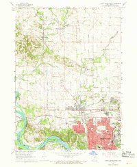
1967 Map of Cedar Rapids North
USGS Topo · Published 1969About this map
The Cedar River and a dense network of competing rail lines define the development of northern Cedar Rapids during the late 1960s. This period captures the suburban expansion north into Hiawatha and Robins, where new residential streets meet established infrastructure like the Chicago Rock Island and Pacific and the Illinois Central railroads. The map records a specific moment of mid-century commercial culture, featuring the Lindale Plaza Shopping Center and a Drive-in Theater along the growing corridor of Blairs Ferry Road.
Find a feature on this map
72 named features on this map. Tap any name to fly to it.
Don’t see what you’re looking for? This feature index may not catch every label — zoom into the map to look around manually.
Map Details
Editions of this 1967 Cedar Rapids North Map
2 editions found
Other maps of this area

1887 · Cedar Rapids
USGS Topo · 1:62,500

1888 · Shellsburg
USGS Topo · 1:62,500

1888 · Marion
USGS Topo · 1:62,500

1888 · Amana
USGS Topo · 1:62,500

1889 · Marion
USGS Topo · 1:62,500

1889 · Amana
USGS Topo · 1:62,500

1889 · Shellsburg
USGS Topo · 1:62,500

1891 · Cedar Rapids
USGS Topo · 1:62,500

1899 · Amana
USGS Topo · 1:62,500

1899 · Shellsburg
USGS Topo · 1:62,500