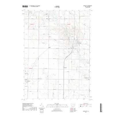
2018 Map of Central City
USGS Topo · Published 2018About this map
The Wapsipinicon River winds through the heart of Linn County, shaping the landscape near Central City and Paris. This 2018 survey reveals a rural terrain defined by established townships and well-connected county roads, where the legacy of early settlers is preserved in numerous family and community burial grounds. Notable sites include Oakhill Cem overlooking the river and Jordan's Grove Cem to the southeast.
Find a feature on this map
87 named features on this map. Tap any name to fly to it.
Don’t see what you’re looking for? This feature index may not catch every label — zoom into the map to look around manually.
Map Details
Editions of this 2018 Central City Map
This is the sole edition of this map. No revisions or reprints were ever made.
Other maps of this area

1888 · Marion
USGS Topo · 1:62,500

1889 · Marion
USGS Topo · 1:62,500

1890 · Anamosa
USGS Topo · 1:62,500

1900 · Anamosa
USGS Topo · 1:125,000

1903 · Winthrop
USGS Topo · 1:125,000

1959 · Dubuque
USGS Topo · 1:250,000

1961 · Dubuque
USGS Topo · 1:250,000

1962 · Dubuque
USGS Topo · 1:250,000
1967 · Cedar Rapids North
USGS Topo · 1:24,000
1968 · Central City
USGS Topo · 1:24,000