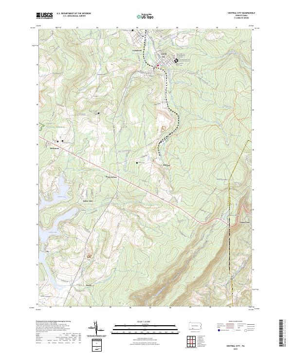
2023 Map of Central City
USGS Topo · Published 2023About this map
Flight 93 National Memorial stands as a significant landmark in this section of Somerset County, marking the landscape west of Cairnbrook and Central City. The topography is defined by the winding paths of Dark Shade Creek and Little Dark Shade Creek, which cut through the ridge-and-valley terrain. Significant genealogical resources are concentrated in the northern settlements, where various religious and community burial grounds like Saint John the Baptist Cem and Saints Peter and Paul Greek Orthodox Cem reflect the heritage of the local workforce. To the south, the artificial shoreline of Indian Lake and the crossroads at Reels Corners indicate the shift toward residential and recreational development. Traces of the region's agricultural and transit history are visible along Old Forbes Rd and the scattered hamlets of Buckstown and Boone.
Find a feature on this map
114 named features on this map. Tap any name to fly to it.
Don’t see what you’re looking for? This feature index may not catch every label — zoom into the map to look around manually.
Map Details
Editions of this 2023 Central City Map
This is the sole edition of this map. No revisions or reprints were ever made.
Other maps of this area

1908 · Bedford
USGS Topo · 1:62,500

1910 · Bedford
USGS Topo · 1:62,500

1914 · Windber
USGS Topo · 1:62,500

1916 · Windber
USGS Topo · 1:62,500

1923 · Berlin
USGS Topo · 1:48,000

1927 · Hyndman
USGS Topo · 1:62,500

1929 · Berlin
USGS Topo · 1:62,500

1931 · Hyndman
USGS Topo · 1:62,500

1944 · Hyndman
USGS Topo · 1:62,500

1944 · Windber
USGS Topo · 1:62,500