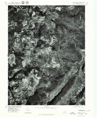
1977 Map of Central City
USGS Topo · Published 1979About this map
Coal-mining heritage and mid-century rural development define this 1970s orthophotoquad of Somerset County. High-contrast aerial imagery reveals the concentrated street grid of Central City and the neighboring settlement of Cairnbrook, areas historically tied to the Berwind-White Coal Mining Company. The landscape is a complex patchwork of small-scale agriculture and industrial activity, where the dark incisions of surface mining and clearings for transmission lines cut through the wooded terrain of the Allegheny Plateau. To the south, the expansion of leisure-focused land use is evident in the developed shorelines of Indian Lake and Lake Stonycreek. The map also captures smaller rural nodes like Reels Corner, Buckstown, and Gahagen, providing a precise visual record of property boundaries, forest cover, and the evolving road network during this era of Pennsylvania's industrial transition.
Find a feature on this map
7 named features on this map. Tap any name to fly to it.
Don’t see what you’re looking for? This feature index may not catch every label — zoom into the map to look around manually.
Map Details
Editions of this 1977 Central City Map
This is the sole edition of this map. No revisions or reprints were ever made.
Other maps of this area

1908 · Bedford
USGS Topo · 1:62,500

1910 · Bedford
USGS Topo · 1:62,500

1914 · Windber
USGS Topo · 1:62,500

1916 · Windber
USGS Topo · 1:62,500

1923 · Berlin
USGS Topo · 1:48,000

1927 · Hyndman
USGS Topo · 1:62,500

1929 · Berlin
USGS Topo · 1:62,500

1931 · Hyndman
USGS Topo · 1:62,500

1944 · Hyndman
USGS Topo · 1:62,500

1944 · Windber
USGS Topo · 1:62,500