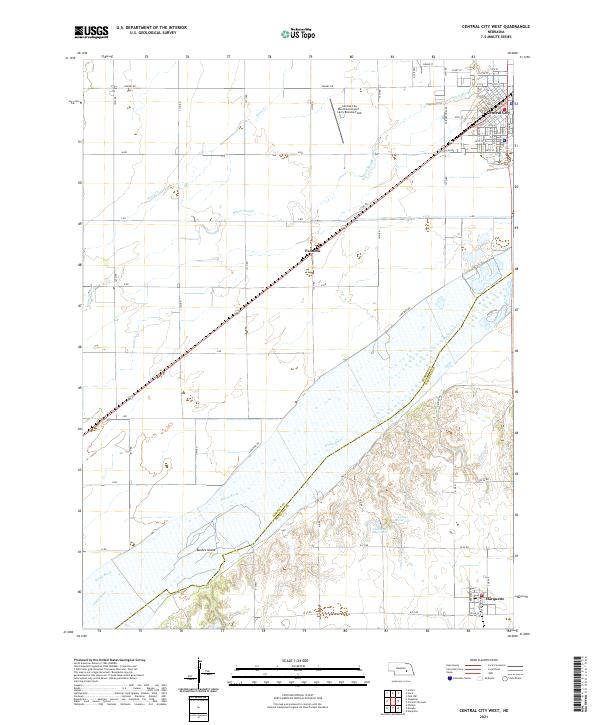
2021 Map of Central City West
USGS Topo · Published 2021About this map
Central City serves as the focal point of this Merrick County survey, situated at the junction of the Union Pacific and Burlington Northern Santa Fe railroads. The town's grid extends toward the Warm Slough and Silver Cr, illustrating a landscape shaped by historical rail traffic and the modern aviation presence at the Central City Municipal Airport - Larry Reineke Field. To the south, the massive braided channel of the Platte River defines the border between Merrick and Hamilton counties, containing notable features like Bushes Island. The agrarian character of the region is evident in the transition from the structured streets of Marquette in the southeast to the smaller settlement of Paddock along the rail line. Small-scale water management is visible through the Larsen Reservoir and Sherman Reservoir, which support the intensive agricultural use of the Platte River valley.
Find a feature on this map
42 named features on this map. Tap any name to fly to it.
Don’t see what you’re looking for? This feature index may not catch every label — zoom into the map to look around manually.
Map Details
Editions of this 2021 Central City West Map
This is the sole edition of this map. No revisions or reprints were ever made.
Other maps of this area

1896 · Stromsburg
USGS Topo · 1:125,000

1898 · York
USGS Topo · 1:125,000

1898 · Grand Island
USGS Topo · 1:125,000

1899 · St. Paul
USGS Topo · 1:125,000

1899 · York
USGS Topo · 1:125,000

1955 · Broken Bow
USGS Topo · 1:250,000

1955 · Fremont
USGS Topo · 1:250,000

1955 · Lincoln
USGS Topo · 1:250,000

1955 · Grand Island
USGS Topo · 1:250,000

1956 · Broken Bow
USGS Topo · 1:250,000