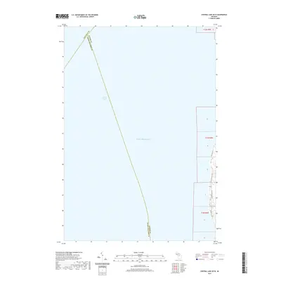
2019 Map of Central Lake OE W
USGS Topo · Published 2019About this map
Lake Michigan dominates this coastal survey, where the waters of Grand Traverse Bay meet the shoreline of the Old Mission Peninsula. The map reveals the precise intersection of three county lines—Leelanau, Antrim, and Grand Traverse—meeting in the open bay. This 2019 data illustrates the modern layout of the narrow eastern shoreline, specifically highlighting the residential corridor defined by Bay View Dr, N Golden Beach Dr, and S Golden Beach Dr. Local navigation is anchored by Creswell Rd and Creswell Ln, which provide access to the thin strip of land between the high-water line and the interior township sections. The survey is particularly useful for understanding the exact division of T30N R9W and adjacent township ranges along this Michigan coastline.
Find a feature on this map
18 named features on this map. Tap any name to fly to it.
Don’t see what you’re looking for? This feature index may not catch every label — zoom into the map to look around manually.
Map Details
Editions of this 2019 Central Lake OE W Map
This is the sole edition of this map. No revisions or reprints were ever made.
Other maps of this area

1954 · Central Lake
USGS Topo · 1:62,500

1954 · Traverse City
USGS Topo · 1:250,000

1955 · Cheboygan
USGS Topo · 1:250,000

1957 · Traverse City
USGS Topo · 1:62,500

1957 · Northport
USGS Topo · 1:62,500

1957 · Elk Rapids
USGS Topo · 1:62,500

1958 · Cheboygan
USGS Topo · 1:250,000

1958 · Traverse City
USGS Topo · 1:250,000

1983 · Northport
USGS Topo · 1:25,000

1983 · Omena
USGS Topo · 1:24,000
Featured Places
- Peninsula Township, MI
- Torch Lake Township, MI
- Grand Traverse County, MI
- Antrim County, MI
- United States