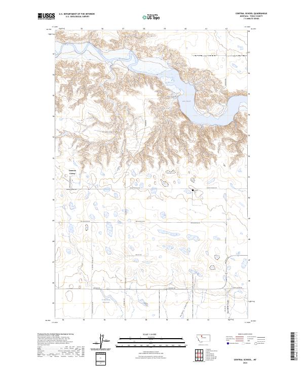
2024 Map of Central School
USGS Topo · Published 2024About this map
Camrose Colony and the small settlement of Omholt anchor this northern Montana landscape, where the flat plains are interrupted by the dramatic carved valleys of the Marias River. The northern portion of the sheet is dominated by the sprawling waters of Lake Elwell, created by the damming of the river, while the southern reaches are defined by the erosive paths of Powder Coulee and East Powder Coulee. This 2024 survey illustrates a landscape shaped by water management and rural infrastructure, from the D Ratzburg Reservoir to the grid of gravel paths like Reclamation Rd and Union School Rd. For local historians, the Omholt Cem remains a significant landmark of the area's early residency, situated near the intersection of several local access roads that connect these isolated agricultural outposts.
Find a feature on this map
26 named features on this map. Tap any name to fly to it.
Don’t see what you’re looking for? This feature index may not catch every label — zoom into the map to look around manually.
Map Details
Editions of this 2024 Central School Map
This is the sole edition of this map. No revisions or reprints were ever made.
Other maps of this area

1920 · Conrad
USGS Topo · 1:125,000

1954 · Shelby
USGS Topo · 1:250,000

1958 · Shelby
USGS Topo · 1:250,000

1967 · Central School
USGS Topo · 1:24,000

1967 · Conrad Butte
USGS Topo · 1:24,000

1967 · South Devon School
USGS Topo · 1:24,000

1967 · Dunkirk
USGS Topo · 1:24,000

1967 · Fowler Coulee NW
USGS Topo · 1:24,000
1967 · Fowler Coulee NE
USGS Topo · 1:24,000

1970 · Sollid School
USGS Topo · 1:24,000