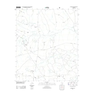
2013 Map of Centralia
USGS Topo · Published 2013About this map
Cochino Bayou and its numerous tributaries, including Garrison Cr and Brushy Cr, dominate this section of Trinity County, defining a landscape of creek bottoms and forested rises. Small, established settlements like Centralia and Hagerville are connected by a network of rural roads and Forest Service routes, such as FS RD 527, which navigate the undulating terrain. The area is marked by several local burial grounds that serve as significant genealogical landmarks, including Enon Cem in the north and Calvary Cem near the southern boundary.
Find a feature on this map
52 named features on this map. Tap any name to fly to it.
Don’t see what you’re looking for? This feature index may not catch every label — zoom into the map to look around manually.
Map Details
Editions of this 2013 Centralia Map
This is the sole edition of this map. No revisions or reprints were ever made.
Other maps of this area

1950 · Kennard NE
USGS Topo · 1:24,000

1950 · Ratcliff
USGS Topo · 1:24,000

1950 · Centralia
USGS Topo · 1:24,000

1951 · Kennard
USGS Topo · 1:24,000

1951 · Wells
USGS Topo · 1:24,000

1951 · Wells SW
USGS Topo · 1:24,000

1951 · Centralia
USGS Topo · 1:24,000

1951 · Kennard NE
USGS Topo · 1:24,000

1951 · Ratcliff
USGS Topo · 1:24,000

1953 · Palestine
USGS Topo · 1:250,000