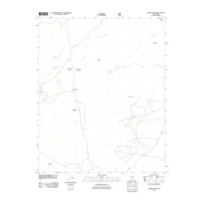
2011 Map of Cerro Alesna
USGS Topo · Published 2011About this map
Cerro Alesna anchors this landscape in the high desert of McKinley County, where the terrain is defined by dramatic elevations and seasonal water sources. The map captures a transition from the elevated peaks of El Dado Peak and the Rincon del Dado in the northeast to the broad expanse of San Lucas Valley in the southwest. Settlement in this arid environment is sparse, centered on the San Miguel Ranch and supported by a network of springs and tanks, including San Miguel Spring and the curious Fort Miguel Ruins Spring.
Find a feature on this map
25 named features on this map. Tap any name to fly to it.
Don’t see what you’re looking for? This feature index may not catch every label — zoom into the map to look around manually.
Map Details
Editions of this 2011 Cerro Alesna Map
This is the sole edition of this map. No revisions or reprints were ever made.
Other maps of this area

1883 · Mt. Taylor
USGS Topo · 1:250,000

1886 · Mt. Taylor
USGS Topo · 1:250,000

1892 · Mt. Taylor
USGS Topo · 1:250,000

1899 · Mt. Taylor
USGS Topo · 1:250,000

1958 · Albuquerque
USGS Topo · 1:250,000

1961 · El Dado
USGS Topo · 1:24,000

1961 · Piedra De La Aguila
USGS Topo · 1:24,000

1961 · El Dado Mesa
USGS Topo · 1:24,000
1961 · Laguna Canoneros
USGS Topo · 1:24,000
1961 · Mesa Cortada
USGS Topo · 1:24,000