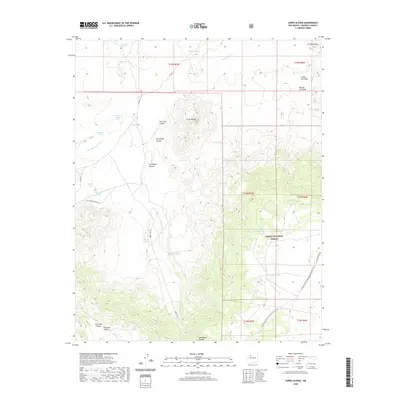
2020 Map of Cerro Alesna
USGS Topo · Published 2020About this map
Cerro Alesna stands as a prominent landmark in this high-desert region of McKinley County, surrounded by a complex network of canyons and seasonal water sources. The landscape is defined by its drainages, including San Miguel Canyon and Las Yeguas Canyon, which channel water toward the arid plains. Evidence of historical land use and vital water management is scattered throughout the area, represented by features like Telesfors Tank and the notable Fort Miguel Ruins Spring.
Find a feature on this map
35 named features on this map. Tap any name to fly to it.
Don’t see what you’re looking for? This feature index may not catch every label — zoom into the map to look around manually.
Map Details
Editions of this 2020 Cerro Alesna Map
This is the sole edition of this map. No revisions or reprints were ever made.
Other maps of this area

1883 · Mt. Taylor
USGS Topo · 1:250,000

1886 · Mt. Taylor
USGS Topo · 1:250,000

1892 · Mt. Taylor
USGS Topo · 1:250,000

1899 · Mt. Taylor
USGS Topo · 1:250,000

1958 · Albuquerque
USGS Topo · 1:250,000

1961 · El Dado
USGS Topo · 1:24,000

1961 · Piedra De La Aguila
USGS Topo · 1:24,000

1961 · El Dado Mesa
USGS Topo · 1:24,000
1961 · Laguna Canoneros
USGS Topo · 1:24,000
1961 · Mesa Cortada
USGS Topo · 1:24,000