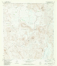
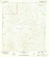
1971 Map of Cerro Castellan
USGS Topo · Published 1980About this map
Cerro Castellan rises as a prominent landmark within the expanse of Big Bend National Park in this 1971 survey. The landscape is defined by its significant topographic relief, from the volcanic spires of the Mule Ear Peaks to the broad plateau of Burro Mesa. For historians and researchers, the map identifies specific points of human activity and passage, including ruins near Tule Spring and a primitive transportation network consisting of the Chimneys Trail and various other pack trails. Water sources were critical in this arid environment, marked here by Mule Ear Spring, Burro Spring, and Wasp Spring. Dramatic geological features like Tuff Canyon and The Chimneys are clearly delineated alongside the Chisos Mountains foothills, showing the park's interior before the increase in modern visitor infrastructure.
Find a feature on this map
27 named features on this map. Tap any name to fly to it.
Don’t see what you’re looking for? This feature index may not catch every label — zoom into the map to look around manually.
Map Details
Editions of this 1971 Cerro Castellan Map
4 editions found
Other maps of this area

1903 · Chisos Mountains
USGS Topo · 1:125,000

1903 · Terlingua
USGS Topo · 1:125,000

1904 · Terlingua
USGS Topo · 1:125,000

1905 · Chisos Mountains
USGS Topo · 1:125,000

1959 · Emory Peak
USGS Topo · 1:250,000

1965 · Emory Peak
USGS Topo · 1:250,000

1971 · Terlingua
USGS Topo · 1:24,000

1971 · Cerro Castellan
USGS Topo · 1:24,000
1971 · Reed Camp
USGS Topo · 1:24,000
1971 · Tule Mountain
USGS Topo · 1:24,000